


Introduction
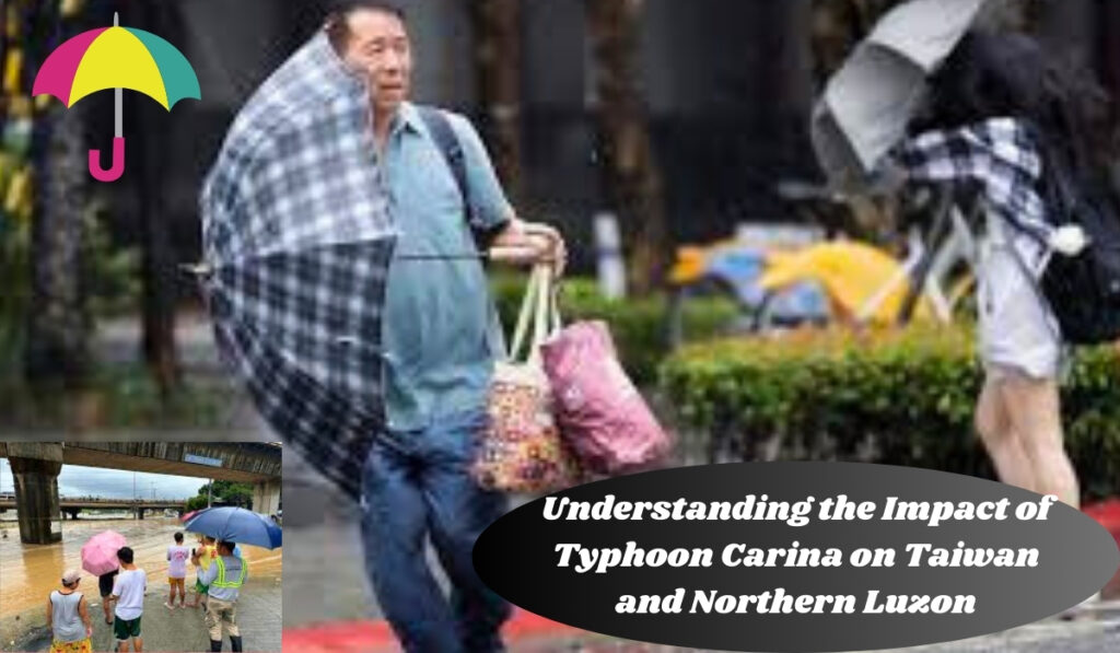
Typhoon Carina, known locally as Typhoon Gaemi, has been causing significant concern due to its movement over the sea east of Taiwan. As it accelerates and strengthens, various regions in Northern Luzon, Philippines, remain under weather advisories. This article provides a detailed analysis of Typhoon Carina’s trajectory, its impact, and safety precautions for affected areas.
Typhoon Carina’s Current Status
As of the evening of July 23, Typhoon Carina was positioned 335 kilometers northeast of Basco, Batanes, or 320 kilometers northeast of Itbayat, Batanes. The typhoon has accelerated north northwest at 25 km/h, with maximum sustained winds of 150 km/h and gustiness up to 185 km/h. The Philippine Atmospheric, Geophysical, and Astronomical Services Administration (PAGASA) forecasts that Carina may strengthen further, reaching its peak intensity by July 24.
Areas Under Tropical Cyclone Wind Signals
- Signal No. 2 (Gale-force winds 62 to 88 km/h)
- Batanes
- Signal No. 1 (Strong winds 39 to 61 km/h)
- Babuyan Islands
- Northern part of mainland Cagayan (Claveria, Santa Praxedes, Sanchez-Mira, Pamplona, Abulug, Ballesteros, Aparri, Camalaniugan, Buguey, Santa Teresita, Santa Ana, Gonzaga)
- Northern part of Ilocos Norte (Burgos, Bangui, Pagudpud, Dumalneg, Adams)
Rainfall Warnings and Expected Impact
Batanes and Babuyan Islands are forecasted to experience moderate to heavy rain (50-100 millimeters) due to Typhoon Carina. Additionally, the southwest monsoon, enhanced by Carina, will bring significant rainfall to several regions. Here is a detailed forecast:
- July 24
- Heavy to intense rain (100-200 mm): Ilocos Region, Abra, Benguet, Zambales, Bataan, Occidental Mindoro
- Moderate to heavy rain (50-100 mm): Metro Manila, Cordillera Administrative Region, Tarlac, Nueva Ecija, Pampanga, Bulacan, Rizal, Cavite, Laguna, Batangas, Oriental Mindoro, Calamian Islands
- July 25
- Expect moderate to heavy rainfall (50-100 mm) in Batanes, Babuyan Islands, Ilocos Region, Apayao, Abra, Benguet, Zambales, Bataan, and Occidental Mindoro.
- July 26
- Expect moderate to heavy rainfall (50-100 mm) in the areas of Zambales and Bataan.
Residents in these areas are advised to prepare for potential floods and landslides due to the heavy rainfall.
Wind and Sea Conditions
Strong to gale-force gusts from the enhanced southwest monsoon will affect various regions. On July 24, regions such as Babuyan Islands, Ilocos Region, Abra, Benguet, Nueva Vizcaya, Quirino, Central Luzon, Metro Manila, Calabarzon, Mimaropa, Bicol, Visayas, and Northern Mindanao will experience strong winds.
A gale warning remains in effect for the coastal waters of Batanes, Babuyan Islands, and northeastern Cagayan (Santa Ana, Gonzaga, Santa Teresita, Buguey). The sea conditions will be rough to very rough, with waves reaching 2.8 to 4.5 meters high, making travel risky for small boats.
Potential Landfall and Trajectory
While Typhoon Carina did not make landfall in the Philippines, it is projected to possibly make landfall in northern Taiwan by the afternoon or evening of July 24. The typhoon is expected to cross Taiwan and exit the Philippine Area of Responsibility (PAR) by the evening of July 24 or early morning of July 25. Following its exit from PAR, Carina is anticipated to move across the Taiwan Strait and make its final landfall over southeastern China on July 25.
Conclusion
Typhoon Carina is shaping up to be a major weather event with the potential to significantly affect both Taiwan and Northern Luzon. As the storm approaches, it is important for residents in the impacted regions to stay vigilant and informed by closely following updates from the Philippine Atmospheric, Geophysical and Astronomical Services Administration (PAGASA) and local authorities.
Typhoon Carina is expected to bring severe weather conditions, including intense rainfall and strong winds, which could lead to hazardous situations such as flooding, landslides, and structural damage. In light of these potential impacts, it is essential for individuals and communities to take precautionary measures to safeguard their well-being.
This includes preparing emergency kits with essential supplies, securing homes and properties, and making contingency plans for possible evacuations. Additionally, staying tuned to weather advisories and following guidance from local emergency services will help ensure timely responses to any changes in the storm’s trajectory or intensity. By taking these proactive steps, residents can better protect themselves and their families during this challenging weather event, minimizing the risk of harm and ensuring a more coordinated and effective response to Typhoon Carina’s impacts.
References
- Philippine Atmospheric, Geophysical, and Astronomical Services Administration (PAGASA)
- Rappler.com
This article aims to provide a comprehensive understanding of Typhoon Carina’s impact, ensuring that readers are well-informed and prepared for the potential weather challenges ahead.
Table of Contents

